
Mapa topográfico Osage
Mapa interactivo
Haga clic en el mapa para ver la altitud.
Acerca de este mapa
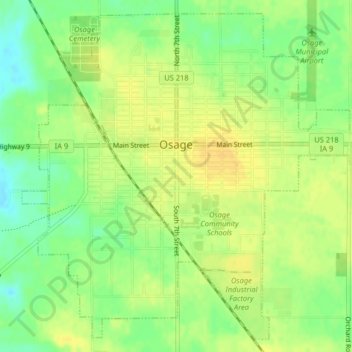
Nombre: Mapa topográfico Osage, altitud, relieve.
Lugar: Osage, Mitchell County, Iowa, 50461, United States (43.26778 -92.82896 43.29506 -92.78852)
Altitud media: 354 m
Altitud mínima: 339 m
Altitud máxima: 364 m
Otros mapas topográficos
Haga clic en un mapa para ver su topografía, su altitud y su relieve.
Mitchell
United States > Iowa > Mitchell County
Mitchell, Mitchell County, Iowa, United States
Altitud media: 357 m
Stacyville
United States > Iowa > Mitchell County > Stacyville
Stacyville, Mitchell County, Iowa, 50476, United States
Altitud media: 372 m
Saint Ansgar
United States > Iowa > Mitchell County
Saint Ansgar, Mitchell County, Iowa, United States
Altitud media: 354 m
Stacyville
United States > Iowa > Mitchell County
Stacyville, Mitchell County, Iowa, United States
Altitud media: 370 m